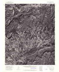
1972 Map of Hulbert SW
USGS Topo · Published 1974About this map
Fort Gibson sits at the heart of this orthophotomosaic, which blends the precision of topographic surveying with the visual detail of aerial photography taken in late 1972. The landscape is defined by the managed waters of Fort Gibson Lake and the engineering of the Fort Gibson Dam, which controls the flow of the Neosho River. This composite image reveals the intricate patchwork of land use, from the dense woodlands of the Oklahoma hills to the structured agricultural plots and residential blocks of the settlement. The contrast between the dark, reflective water of the lake and the textured, varied terrain of the surrounding countryside offers a clear view of the regional topography before mid-seventies development altered the local environment.
Find a feature on this map
4 named features on this map. Tap any name to fly to it.
Don’t see what you’re looking for? This feature index may not catch every label — zoom into the map to look around manually.
Map Details
Editions of this 1972 Hulbert SW Map
This is the sole edition of this map. No revisions or reprints were ever made.
Other maps of this area

1901 · Muscogee
USGS Topo · 1:125,000

1905 · Muscogee
USGS Topo · 1:125,000

1946 · Fort Smith
USGS Topo · 1:250,000

1948 · Hulbert
USGS Topo · 1:62,500

1948 · Keefeton
USGS Topo · 1:62,500

1948 · Webbers Falls
USGS Topo · 1:62,500

1948 · Wagoner
USGS Topo · 1:62,500

1950 · Keefeton
USGS Topo · 1:62,500

1950 · Wagoner
USGS Topo · 1:62,500

1950 · Hulbert
USGS Topo · 1:62,500