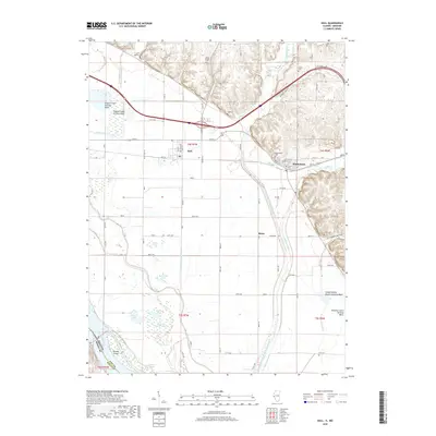
2018 Map of Hull
USGS Topo · Published 2018About this map
The village of Hull and the town of Kinderhook serve as the primary anchors for this region in Pike County, where the bottomlands meet the rising bluffs. This landscape is defined by its complex water management systems, notably the Hadley-McCraney Diversion Ditch and the Pigeon Creek Settling Basin, which reflect the long-standing efforts to reclaim and protect these fertile plains from the nearby Mississippi River. Genealogists will find a wealth of data across several burial grounds, including Akers Chapel Cem, Journey Cem, and the House Cem. The southern reach of the map transitions into a wetlands environment characterized by Broad Apron Lake, Pin Oak Lake, and The Sny, a notable waterway following the ancient river channel. This area near Shinn highlights the transition from organized agriculture to the untamed river banks of Browns Island and James Break.
Find a feature on this map
99 named features on this map. Tap any name to fly to it.
Don’t see what you’re looking for? This feature index may not catch every label — zoom into the map to look around manually.
Map Details
Editions of this 2018 Hull Map
This is the sole edition of this map. No revisions or reprints were ever made.
Other maps of this area

1925 · Quincy
USGS Topo · 1:62,500

1925 · Liberty
USGS Topo · 1:62,500

1927 · Liberty
USGS Topo · 1:62,500

1931 · Barry
USGS Topo · 1:62,500

1932 · Hannibal
USGS Topo · 1:62,500

1936 · Hannibal
USGS Topo · 1:48,000

1936 · Barry
USGS Topo · 1:48,000

1944 · Barry
USGS Topo · 1:62,500

1944 · Quincy
USGS Topo · 1:62,500

1945 · Hannibal
USGS Topo · 1:62,500