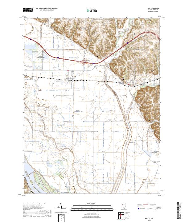
2024 Map of Hull
USGS Topo · Published 2024About this map
Hull and Kinderhook anchor this landscape where the flat alluvial plains of the Mississippi River meet the rising bluffs of Pike County. The area is defined by an intricate network of drainage and water management, featuring the The Sny, Hadley-McCraney Diversion Ditch, and Walnut Creek Ditch, alongside numerous settling basins like the Pigeon Creek Settling Basin. For genealogists, the map is particularly rich in burial sites, documenting Akers Chapel Cem, Kinderhook Cem, and the family-named House Cem and Long Cem tucked into the hills and valleys. The transition from the low-lying wetlands of Broad Apron Lake and Trester Lake to the higher elevations of Grubb Hollow illustrates the historical challenge of reclaiming these fertile river bottoms for agriculture while maintaining the primary channel of the Mississippi River at the western boundary.
Find a feature on this map
68 named features on this map. Tap any name to fly to it.
Don’t see what you’re looking for? This feature index may not catch every label — zoom into the map to look around manually.
Map Details
Editions of this 2024 Hull Map
This is the sole edition of this map. No revisions or reprints were ever made.
Other maps of this area

1925 · Quincy
USGS Topo · 1:62,500

1925 · Liberty
USGS Topo · 1:62,500

1927 · Liberty
USGS Topo · 1:62,500

1931 · Barry
USGS Topo · 1:62,500

1932 · Hannibal
USGS Topo · 1:62,500

1936 · Hannibal
USGS Topo · 1:48,000

1936 · Barry
USGS Topo · 1:48,000

1944 · Barry
USGS Topo · 1:62,500

1944 · Quincy
USGS Topo · 1:62,500

1945 · Hannibal
USGS Topo · 1:62,500