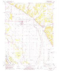
1978 Map of Hull
USGS Topo · Published 1978About this map
The Mississippi River and its intricate system of flood controls dominate this landscape near the Illinois-Missouri border. Engineered features like the Lock and Dam No 22 and an extensive network of Levee and Ditch systems illustrate the ongoing efforts to manage the river's influence on the fertile bottomlands. These lowlands are dotted with numerous water bodies and settling basins, including Broad Apron Lake, Pin Oak Lake, and the Pigeon Creek Settling Basin, which are separated from the upland bluffs by the Norfolk and Western railroad corridor.
Find a feature on this map
51 named features on this map. Tap any name to fly to it.
Don’t see what you’re looking for? This feature index may not catch every label — zoom into the map to look around manually.
Map Details
Editions of this 1978 Hull Map
This is the sole edition of this map. No revisions or reprints were ever made.
Other maps of this area

1925 · Quincy
USGS Topo · 1:62,500

1925 · Liberty
USGS Topo · 1:62,500

1927 · Liberty
USGS Topo · 1:62,500

1931 · Barry
USGS Topo · 1:62,500

1932 · Hannibal
USGS Topo · 1:62,500

1936 · Hannibal
USGS Topo · 1:48,000

1936 · Barry
USGS Topo · 1:48,000

1944 · Barry
USGS Topo · 1:62,500

1944 · Quincy
USGS Topo · 1:62,500

1945 · Hannibal
USGS Topo · 1:62,500