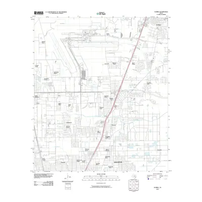
2010 Map of Humble
USGS Topo · Published 2010About this map
George Bush Intercontinental Airport-Houston dominates the northern landscape of this Harris County quadrangle, showing the massive footprint of the runways and terminals as they appeared in 2010. Below the airport, the terrain transitions into a dense network of suburban developments and established communities, including Aldine City, Mount Houston, and Dyersdale. Waterways such as Greens Bayou and Halls Bayou wind through these residential areas, providing a natural structure to the grid of streets and modern tollways like Beltway 8.
Find a feature on this map
69 named features on this map. Tap any name to fly to it.
Don’t see what you’re looking for? This feature index may not catch every label — zoom into the map to look around manually.
Map Details
Editions of this 2010 Humble Map
This is the sole edition of this map. No revisions or reprints were ever made.
Other maps of this area

1915 · Houston Heights
USGS Topo · 1:24,000

1916 · Aldine
USGS Topo · 1:24,000

1916 · Settegast
USGS Topo · 1:24,000

1916 · Fauna
USGS Topo · 1:24,000

1916 · Harmaston
USGS Topo · 1:24,000

1916 · Moonshine Hill
USGS Topo · 1:24,000

1916 · Humble
USGS Topo · 1:24,000

1916 · Spring
USGS Topo · 1:24,000

1919 · Aldine
USGS Topo · 1:31,680

1919 · Humble
USGS Topo · 1:31,680