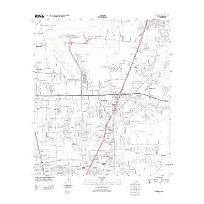
2013 Map of Humble
USGS Topo · Published 2013About this map
George Bush Intercontinental/Houston Airport dominates the northern landscape of this Harris County quadrant, its runways and taxiways carved out of the drainage basins of Garners Bayou and Greens Bayou. South of the airport, a dense network of suburban developments and established neighborhoods illustrates the rapid expansion of the Houston metropolitan area in the early 21st century. Places like Aldine City, Mount Houston, and Dyersdale are woven together by major transportation arteries including the N Sam Houston Pkwy E and Will Clayton Pkwy.
Find a feature on this map
63 named features on this map. Tap any name to fly to it.
Don’t see what you’re looking for? This feature index may not catch every label — zoom into the map to look around manually.
Map Details
Editions of this 2013 Humble Map
This is the sole edition of this map. No revisions or reprints were ever made.
Other maps of this area

1915 · Houston Heights
USGS Topo · 1:24,000

1916 · Aldine
USGS Topo · 1:24,000

1916 · Settegast
USGS Topo · 1:24,000

1916 · Fauna
USGS Topo · 1:24,000

1916 · Harmaston
USGS Topo · 1:24,000

1916 · Moonshine Hill
USGS Topo · 1:24,000

1916 · Humble
USGS Topo · 1:24,000

1916 · Spring
USGS Topo · 1:24,000

1919 · Aldine
USGS Topo · 1:31,680

1919 · Humble
USGS Topo · 1:31,680