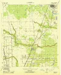
1946 Map of Humble
USGS Topo · Published 1946About this map
The town of Humble serves as the focal point for this mid-1940s landscape, where the Southern Pacific and Missouri Pacific railroads define the industrial and transportation corridors of northern Harris County. To the south, the settlement at Mt Houston is densely platted along Mt Houston Road, while Bordersville sits tucked near the rail lines to the north. This era reveals a transition from rural homesteads toward organized residential growth, yet the drainage patterns of Greens Bayou and Halls Bayou still dominate the topography.
Find a feature on this map
39 named features on this map. Tap any name to fly to it.
Don’t see what you’re looking for? This feature index may not catch every label — zoom into the map to look around manually.
Map Details
Editions of this 1946 Humble Map
This is the sole edition of this map. No revisions or reprints were ever made.
Other maps of this area

1915 · Houston Heights
USGS Topo · 1:24,000

1916 · Aldine
USGS Topo · 1:24,000

1916 · Settegast
USGS Topo · 1:24,000

1916 · Fauna
USGS Topo · 1:24,000

1916 · Harmaston
USGS Topo · 1:24,000

1916 · Moonshine Hill
USGS Topo · 1:24,000

1916 · Humble
USGS Topo · 1:24,000

1916 · Spring
USGS Topo · 1:24,000

1919 · Aldine
USGS Topo · 1:31,680

1919 · Humble
USGS Topo · 1:31,680