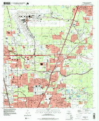
1995 Map of Humble
USGS Topo · Published 1999About this map
The expansive George Bush Intercontinental Airport dominates the northern landscape, its runways and Control Tower reflecting the late-20th-century aviation infrastructure of northern Houston. This 1995 planimetry highlights the residential growth of neighborhoods like Parkwood Estates, Greenwood Village, and Hardy Heights, which are woven between a network of major arteries including Aldine Bender Road and Vickery Road.
Find a feature on this map
60 named features on this map. Tap any name to fly to it.
Don’t see what you’re looking for? This feature index may not catch every label — zoom into the map to look around manually.
Map Details
Editions of this 1995 Humble Map
This is the sole edition of this map. No revisions or reprints were ever made.
Other maps of this area

1915 · Houston Heights
USGS Topo · 1:24,000

1916 · Aldine
USGS Topo · 1:24,000

1916 · Settegast
USGS Topo · 1:24,000

1916 · Fauna
USGS Topo · 1:24,000

1916 · Harmaston
USGS Topo · 1:24,000

1916 · Moonshine Hill
USGS Topo · 1:24,000

1916 · Humble
USGS Topo · 1:24,000

1916 · Spring
USGS Topo · 1:24,000

1919 · Aldine
USGS Topo · 1:31,680

1919 · Humble
USGS Topo · 1:31,680