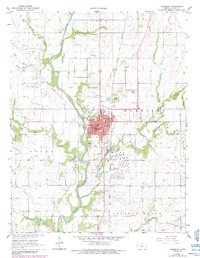
1966 Map of Humboldt
USGS Topo · Published 1984About this map
The Neosho River meanders through the heart of this Allen County landscape, defining the industrial and civic development of Humboldt during the mid-1960s. The town's infrastructure is clearly visible, from the Waterworks and Sewage Disposal plants along the riverbank to the Athletic Field and Riverside Park. Educational and spiritual centers like St Joseph Sch and the High Sch serve as focal points for the community, while the Atchison Topeka and Santa Fe railroad corridor facilitates the local economy.
Find a feature on this map
41 named features on this map. Tap any name to fly to it.
Don’t see what you’re looking for? This feature index may not catch every label — zoom into the map to look around manually.
Map Details
Editions of this 1966 Humboldt Map
2 editions found
Other maps of this area

1886 · Fredonia
USGS Topo · 1:125,000

1886 · Iola
USGS Topo · 1:125,000

1893 · Iola
USGS Topo · 1:125,000

1894 · Fredonia
USGS Topo · 1:125,000

1904 · Iola
USGS Topo · 1:125,000

1938 · Altoona
USGS Topo · 1:62,500

1939 · Altoona
USGS Topo · 1:48,000

1943 · Altoona
USGS Topo · 1:62,500

1947 · Joplin
USGS Topo · 1:250,000

1949 · Joplin
USGS Topo · 1:250,000