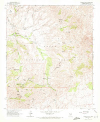
1964 Map of Humboldt Mtn.
USGS Topo · Published 1972About this map
Humboldt Mtn and the surrounding high desert of the Tonto National Forest dominate this mid-century topographic study. The landscape is defined by its deep drainage networks, including Rackensack Canyon and Sycamore Canyon, where water sources like Mashakattee Spring and Seven Springs supported early ranching and recreational use. The presence of Cartwright Ranch and Sears Kay Ranch highlights the pastoral economy of this section of Maricopa County, while scattered Ruins and remnants of a Mill point to older, transient activities in the canyons.
Find a feature on this map
63 named features on this map. Tap any name to fly to it.
Don’t see what you’re looking for? This feature index may not catch every label — zoom into the map to look around manually.
Map Details
Editions of this 1964 Humboldt Mtn. Map
4 editions found
Other maps of this area

1887 · Verde
USGS Topo · 1:250,000

1892 · Verde
USGS Topo · 1:250,000

1929 · Turret Peak
USGS Topo · 1:125,000

1930 · Cave Creek
USGS Topo · 1:125,000

1933 · Turret Peak
USGS Topo · 1:125,000

1939 · Cave Creek
USGS Topo · 1:125,000

1954 · Holbrook
USGS Topo · 1:250,000

1954 · Mesa
USGS Topo · 1:250,000

1957 · Mesa
USGS Topo · 1:250,000

1957 · Holbrook
USGS Topo · 1:250,000