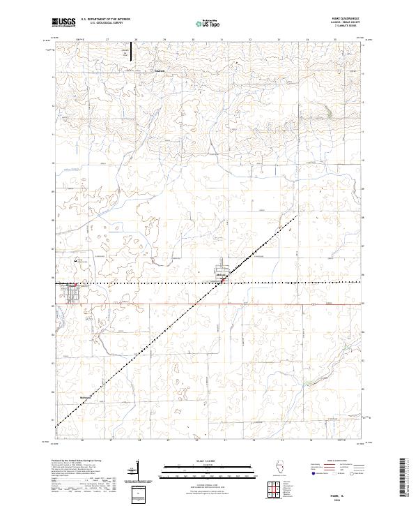
2024 Map of Hume
USGS Topo · Published 2024About this map
The agricultural landscape of Edgar County centers on Hume and Metcalf in this 2024 survey, illustrating a region defined by its orthogonal road grid and water management. Local landmarks like the Young America Cem provide historical grounding for genealogists, while Hildreth Air Park near the small settlement of Hildreth reflects modern land use alongside traditional farming. The area is drained by a network of waterways including Brushy Fork, Clark Branch, and Gilkey Branch, alongside the engineered Shioh Number 2 Drain. These features together show a rural Illinois community where the legacy of early settlements like Melwood persists within a highly organized township and range system. The map detail extends to individual village streets, including Crawford St and Front St, offering a clear view of these small-town interiors.
Find a feature on this map
36 named features on this map. Tap any name to fly to it.
Don’t see what you’re looking for? This feature index may not catch every label — zoom into the map to look around manually.
Map Details
Editions of this 2024 Hume Map
This is the sole edition of this map. No revisions or reprints were ever made.
Other maps of this area

1946 · Kansas
USGS Topo · 1:62,500

1947 · Ridge Farm
USGS Topo · 1:62,500

1947 · Paris
USGS Topo · 1:62,500

1949 · Kansas
USGS Topo · 1:62,500

1949 · Paris
USGS Topo · 1:62,500

1953 · Indianapolis
USGS Topo · 1:250,000

1956 · Indianapolis
USGS Topo · 1:250,000

1956 · Newman
USGS Topo · 1:62,500

1957 · Indianapolis
USGS Topo · 1:250,000

1962 · Indianapolis
USGS Topo · 1:250,000