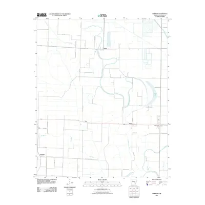
2011 Map of Humnoke
USGS Topo · Published 2011About this map
The town of Humnoke stands as a focal point in this agricultural landscape of Lonoke County, situated at a vital road junction near the edge of the sheet. The terrain is defined by a complex network of waterways, most notably the meandering path of Crooked Creek and the southern stretches of Salt Bayou. These watercourses dictate the local geography, leading toward features like Jordan Brake, a distinctive natural basin in the eastern portion of the quadrangle. Smaller settlements such as Allport, Ryan, and Seaton are linked by a grid of rural roads, many bearing family names like Perry Rd and Castleberry Rd, reflecting the deep-rooted local history of the region. Genealogists may find value in the location of Gumwood Cemetery, which remains a significant landmark amidst the surrounding farm fields and drainage systems like Big Ditch.
Find a feature on this map
50 named features on this map. Tap any name to fly to it.
Don’t see what you’re looking for? This feature index may not catch every label — zoom into the map to look around manually.
Map Details
Editions of this 2011 Humnoke Map
This is the sole edition of this map. No revisions or reprints were ever made.
Other maps of this area

1935 · Altheimer
USGS Topo · 1:62,500

1937 · Stuttgart
USGS Topo · 1:62,500

1937 · England
USGS Topo · 1:48,000

1939 · Stuttgart
USGS Topo · 1:62,500

1941 · Goldman
USGS Topo · 1:62,500

1943 · England
USGS Topo · 1:62,500

1948 · Helena
USGS Topo · 1:250,000

1950 · Helena
USGS Topo · 1:250,000

1955 · Helena
USGS Topo · 1:250,000

1959 · Helena
USGS Topo · 1:250,000