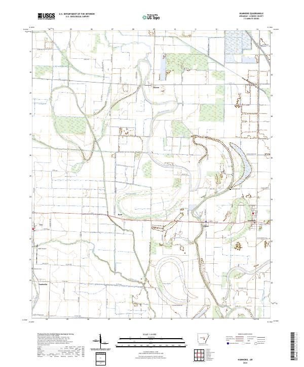
2024 Map of Humnoke
USGS Topo · Published 2024About this map
Humnoke and Allport anchor the eastern side of this Lonoke County landscape, where the meandering course of Crooked Creek defines the local topography. This 2024 survey captures a rural Arkansas environment dominated by water management and localized transport networks, visible through the intricate system of drainages like Big Ditch and Caney Creek. To the west, the settlements of Coy and Ryan sit along established routes, while the southern reaches are marked by the wetlands of McGregor Brake, Piney Brake, and Salt Bayou. Genealogy and local history researchers will find the locations of Gumwood Cem and Tomberlin Cem well-documented, alongside small aviation landmarks like Walls Airport. The map highlights a transition between small agricultural hubs and the natural oxbows and brakes common to this river-influenced region.
Find a feature on this map
67 named features on this map. Tap any name to fly to it.
Don’t see what you’re looking for? This feature index may not catch every label — zoom into the map to look around manually.
Map Details
Editions of this 2024 Humnoke Map
This is the sole edition of this map. No revisions or reprints were ever made.
Other maps of this area

1935 · Altheimer
USGS Topo · 1:62,500

1937 · Stuttgart
USGS Topo · 1:62,500

1937 · England
USGS Topo · 1:48,000

1939 · Stuttgart
USGS Topo · 1:62,500

1941 · Goldman
USGS Topo · 1:62,500

1943 · England
USGS Topo · 1:62,500

1948 · Helena
USGS Topo · 1:250,000

1950 · Helena
USGS Topo · 1:250,000

1955 · Helena
USGS Topo · 1:250,000

1959 · Helena
USGS Topo · 1:250,000