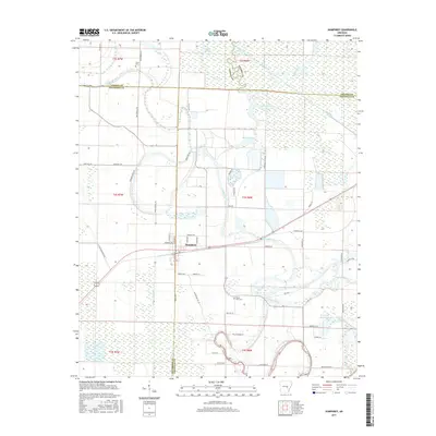
2017 Map of Humphrey
USGS Topo · Published 2017About this map
Humphrey sits at a geographic crossroads where Lonoke, Jefferson, and Arkansas counties meet. This landscape is defined by its complex hydrology, dominated by the winding path of Bayou Meto and the straightened channels of the Big Ditch. The map illustrates a rural Arkansas economy heavily reliant on water management and irrigation, evidenced by features such as Randolph Reservoir and Hufford Brake. The proximity of the town to these drainage networks highlights the effort to reclaim and utilize the fertile but swampy bottomlands characteristic of this region.
Find a feature on this map
63 named features on this map. Tap any name to fly to it.
Don’t see what you’re looking for? This feature index may not catch every label — zoom into the map to look around manually.
Map Details
Editions of this 2017 Humphrey Map
This is the sole edition of this map. No revisions or reprints were ever made.
Other maps of this area

1935 · Altheimer
USGS Topo · 1:62,500

1937 · Stuttgart
USGS Topo · 1:62,500

1937 · England
USGS Topo · 1:48,000

1939 · Stuttgart
USGS Topo · 1:62,500

1941 · Goldman
USGS Topo · 1:62,500

1943 · England
USGS Topo · 1:62,500

1948 · Helena
USGS Topo · 1:250,000

1950 · Helena
USGS Topo · 1:250,000

1955 · Helena
USGS Topo · 1:250,000

1959 · Helena
USGS Topo · 1:250,000