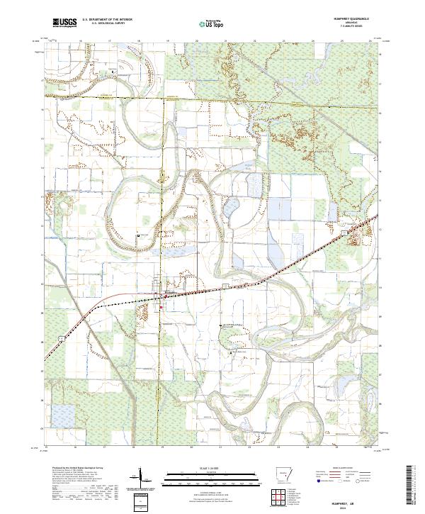
2024 Map of Humphrey
USGS Topo · Published 2024About this map
Humphrey sits at the intersection of four counties—Lonoke, Jefferson, Arkansas, and Prairie—forming a complex border junction in this low-lying agricultural landscape. The town is defined by a grid of streets like N Division St and Buerkle Ave, surrounded by a network of drainage and natural waterways including Crooked Creek and Bayou Meto. Local history is preserved in several family and community burial grounds, such as Flynn Cem, Cline Cem, and Lee and Anthony Cem, which are scattered throughout the surrounding farmland. The terrain is notably marked by hydraulic features like Big Ditch, Hufford Brake, and Bear Slough, reflecting the region's managed wetlands and irrigation patterns. Numerous rural roads, including Nel Mar and Flynn Bridge Rd, connect the isolated farmsteads to the central hub of Humphrey.
Find a feature on this map
61 named features on this map. Tap any name to fly to it.
Don’t see what you’re looking for? This feature index may not catch every label — zoom into the map to look around manually.
Map Details
Editions of this 2024 Humphrey Map
This is the sole edition of this map. No revisions or reprints were ever made.
Other maps of this area

1935 · Altheimer
USGS Topo · 1:62,500

1937 · Stuttgart
USGS Topo · 1:62,500

1937 · England
USGS Topo · 1:48,000

1939 · Stuttgart
USGS Topo · 1:62,500

1941 · Goldman
USGS Topo · 1:62,500

1943 · England
USGS Topo · 1:62,500

1948 · Helena
USGS Topo · 1:250,000

1950 · Helena
USGS Topo · 1:250,000

1955 · Helena
USGS Topo · 1:250,000

1959 · Helena
USGS Topo · 1:250,000