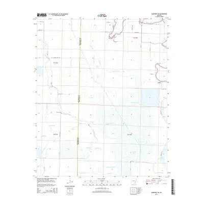
2014 Map of Humphrey SW
USGS Topo · Published 2014About this map
Wabbaseka Bayou and the meandering Bayou Meto dominate this delta landscape along the border of Jefferson and Arkansas Counties. This region is defined by an intricate network of waterways and low-lying basins, including named sloughs like Government Cypress Slough and Bubbling Slough. The small settlement of Vallier sits on the eastern edge of the survey, connected by a grid of rural routes such as Vallier Rd and Cox Cypress Rd.
Find a feature on this map
60 named features on this map. Tap any name to fly to it.
Don’t see what you’re looking for? This feature index may not catch every label — zoom into the map to look around manually.
Map Details
Editions of this 2014 Humphrey SW Map
This is the sole edition of this map. No revisions or reprints were ever made.
Other maps of this area

1935 · Altheimer
USGS Topo · 1:62,500

1935 · Varner
USGS Topo · 1:62,500

1935 · Noble Lake
USGS Topo · 1:62,500

1941 · Goldman
USGS Topo · 1:62,500

1948 · Helena
USGS Topo · 1:250,000

1950 · Helena
USGS Topo · 1:250,000

1955 · Helena
USGS Topo · 1:250,000

1959 · Helena
USGS Topo · 1:250,000

1960 · Helena
USGS Topo · 1:250,000
1964 · Cornerstone
USGS Topo · 1:24,000