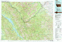
1981 Map of Hungry Horse Reservoir
USGS Topo · Published 1982About this map
Hungry Horse Reservoir dominates the western portion of this 1981 survey, where the dammed waters of the South Fork Flathead River fill the deep valleys between Emery Ridge and Pioneer Ridge. The landscape is a study in transport corridors through difficult terrain, most notably along the Middle Fork Flathead River where the Theodore Roosevelt Highway and the Burlington Northern railroad track through the John F Stevens Canyon. This route connects small mountain settlements like Nyack, Paola, Essex, and Walton as it climbs toward the Continental Divide.
Find a feature on this map
154 named features on this map. Tap any name to fly to it.
Don’t see what you’re looking for? This feature index may not catch every label — zoom into the map to look around manually.
Map Details
Editions of this 1981 Hungry Horse Reservoir Map
This is the sole edition of this map. No revisions or reprints were ever made.
Other maps of this area

1901 · Browning
USGS Topo · 1:125,000

1903 · Browning
USGS Topo · 1:125,000

1903 · Saypo
USGS Topo · 1:125,000

1904 · Chief Mountain
USGS Topo · 1:125,000

1906 · Kintla Lakes
USGS Topo · 1:125,000

1911 · Blackfoot
USGS Topo · 1:125,000

1913 · Marias Pass
USGS Topo · 1:125,000

1914 · Nyack
USGS Topo · 1:125,000

1914 · Heart Butte
USGS Topo · 1:125,000

1918 · Heart Butte
USGS Topo · 1:125,000