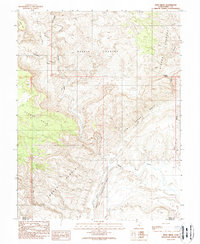
1988 Map of Hunt Draw
USGS Topo · Published 1988About this map
San Rafael Reef and the North Caineville Reef dominate this desert landscape where the borders of Emery and Wayne counties meet. The complex topography is defined by the winding course of Muddy Creek, which cuts through the dramatic geological upturns of the Moroni Slopes. The area is characterized by vast, unnamed spaces interspersed with regional identifiers like Keesle Country and Sinbad Country, reflecting the isolated nature of the Utah backcountry in the late 20th century.
Find a feature on this map
18 named features on this map. Tap any name to fly to it.
Don’t see what you’re looking for? This feature index may not catch every label — zoom into the map to look around manually.
Map Details
Editions of this 1988 Hunt Draw Map
2 editions found
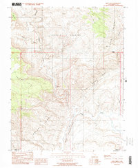
Other maps of this area

1885 · San Rafael
USGS Topo · 1:250,000

1885 · Fish Lake
USGS Topo · 1:250,000

1896 · Fish Lake
USGS Topo · 1:250,000

1952 · Wild Horse
USGS Topo · 1:62,500

1953 · Emery 4 NE
USGS Topo · 1:24,000

1953 · Emery 4 SE
USGS Topo · 1:24,000

1954 · Stinking Spring Creek 3 NW
USGS Topo · 1:24,000

1954 · Stinking Spring Creek 3 SE
USGS Topo · 1:24,000

1954 · Stinking Spring Creek 3 SW
USGS Topo · 1:24,000
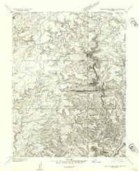
1954 · Stinking Spring Creek 3 NE
USGS Topo · 1:24,000