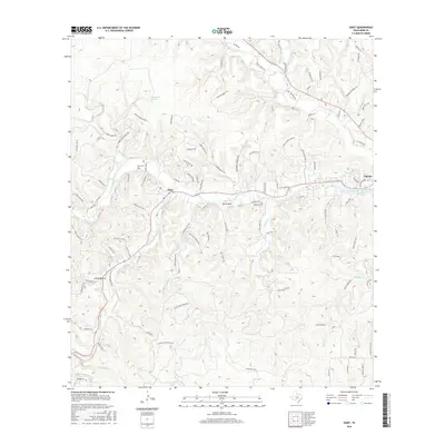
2016 Map of Hunt
USGS Topo · Published 2016About this map
The confluence of the N Fork Guadalupe River and S Fork Guadalupe River anchors this Kerr County landscape, centered on the community of Hunt. The terrain is defined by deep drainages like Ox Hollow and Lange Ravine, which feed into the main river system. Toward the east, the settlement of Ingram borders several impoundments, including Lake New Ingram and Lake Old Ingram, reflecting the local management of the Guadalupe’s waters for recreation or utility.
Find a feature on this map
102 named features on this map. Tap any name to fly to it.
Don’t see what you’re looking for? This feature index may not catch every label — zoom into the map to look around manually.
Map Details
Editions of this 2016 Hunt Map
This is the sole edition of this map. No revisions or reprints were ever made.
Other maps of this area

1894 · Kerrville
USGS Topo · 1:125,000

1954 · Llano
USGS Topo · 1:250,000

1954 · San Antonio
USGS Topo · 1:250,000

1955 · Llano
USGS Topo · 1:250,000

1956 · Tuff
USGS Topo · 1:62,500

1956 · Center Point
USGS Topo · 1:62,500

1956 · Llano
USGS Topo · 1:250,000

1957 · San Antonio
USGS Topo · 1:250,000

1964 · Nott Branch
USGS Topo · 1:24,000

1964 · Diamond S Ranch
USGS Topo · 1:24,000