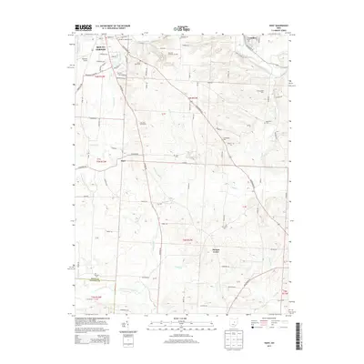
2013 Map of Hunt
USGS Topo · Published 2013About this map
Mount Vernon serves as the northern anchor of this Knox County landscape, where the Mt Vernon Nazarene Univ campus and Wynkoop Airport transition into the agricultural valleys of central Ohio. The terrain is defined by a series of south-flowing waterways, including Delano Run, Sycamore Cr, and Big Run, which carve through the plateau between Gambier and the small crossroads of Hunt. These streams eventually feed the Kokosing River to the north and the North Fork Licking River at the southern boundary, illustrating the regional drainage divide.
Find a feature on this map
100 named features on this map. Tap any name to fly to it.
Don’t see what you’re looking for? This feature index may not catch every label — zoom into the map to look around manually.
Map Details
Editions of this 2013 Hunt Map
This is the sole edition of this map. No revisions or reprints were ever made.
Other maps of this area

1908 · Granville
USGS Topo · 1:62,500

1909 · Newark
USGS Topo · 1:62,500

1910 · Granville
USGS Topo · 1:62,500

1912 · Gambier
USGS Topo · 1:62,500

1914 · Gambier
USGS Topo · 1:62,500

1915 · Fredericktown
USGS Topo · 1:62,500

1943 · Gambier
USGS Topo · 1:62,500

1943 · Fredericktown
USGS Topo · 1:62,500

1950 · Marion
USGS Topo · 1:250,000
1961 · Fredonia
USGS Topo · 1:24,000