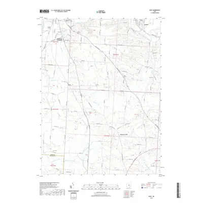
2019 Map of Hunt
USGS Topo · Published 2019About this map
Mount Vernon and Gambier anchor the northern reaches of this Knox County survey, which documents the rural landscape where the Kokosing River and North Fork Licking River drainage systems meet. The presence of both Mount Vernon Nazarene University and Kenyon College highlights the area's educational foundations, while the distribution of numerous country cemeteries, such as Saint Johns Cem and Owl Creek Cem, points to long-established family settlements. South of the larger towns, the crossroads of Hunt and Morgan Center serve as focal points for the agricultural community. The terrain is defined by a dense network of seasonal runs and creeks, including Muckshaw Run, Delano Run, and Tuma Run, which carve through the townships and shape the winding paths of roads like Martinsburg Rd and Newark Rd. Wynkoop Airport provides a distinct aviation landmark in the northwest corner, nestled near the county line.
Find a feature on this map
108 named features on this map. Tap any name to fly to it.
Don’t see what you’re looking for? This feature index may not catch every label — zoom into the map to look around manually.
Map Details
Editions of this 2019 Hunt Map
This is the sole edition of this map. No revisions or reprints were ever made.
Other maps of this area

1908 · Granville
USGS Topo · 1:62,500

1909 · Newark
USGS Topo · 1:62,500

1910 · Granville
USGS Topo · 1:62,500

1912 · Gambier
USGS Topo · 1:62,500

1914 · Gambier
USGS Topo · 1:62,500

1915 · Fredericktown
USGS Topo · 1:62,500

1943 · Gambier
USGS Topo · 1:62,500

1943 · Fredericktown
USGS Topo · 1:62,500

1950 · Marion
USGS Topo · 1:250,000
1961 · Fredonia
USGS Topo · 1:24,000