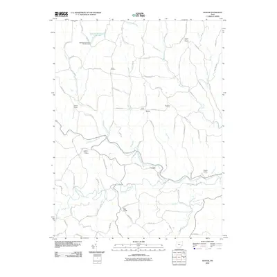
2010 Map of Hunter
USGS Topo · Published 2010About this map
Captina Creek and its many tributaries, including North Fork Captina Creek and South Fork Captina Creek, define the complex drainage patterns of this Belmont County landscape. Small rural settlements like New Castle and Hunter serve as local anchors, connected by a network of township and county roads that follow the ridges and hollows. The area's long-established community history is clearly legible through its numerous burial grounds, including the centrally located Hunter Cemetery and the more remote Mount Horeb Cemetery overlooking the creek valleys.
Find a feature on this map
90 named features on this map. Tap any name to fly to it.
Don’t see what you’re looking for? This feature index may not catch every label — zoom into the map to look around manually.
Map Details
Editions of this 2010 Hunter Map
This is the sole edition of this map. No revisions or reprints were ever made.
Other maps of this area

1903 · Flushing
USGS Topo · 1:62,500

1905 · Clarington
USGS Topo · 1:62,500

1905 · St. Clairsville
USGS Topo · 1:62,500

1905 · Woodsfield
USGS Topo · 1:62,500

1905 · Flushing
USGS Topo · 1:62,500

1935 · Clarington
USGS Topo · 1:62,500

1940 · Clarington
USGS Topo · 1:62,500

1949 · Clarksburg
USGS Topo · 1:250,000

1951 · Canton
USGS Topo · 1:250,000

1953 · Canton
USGS Topo · 1:250,000