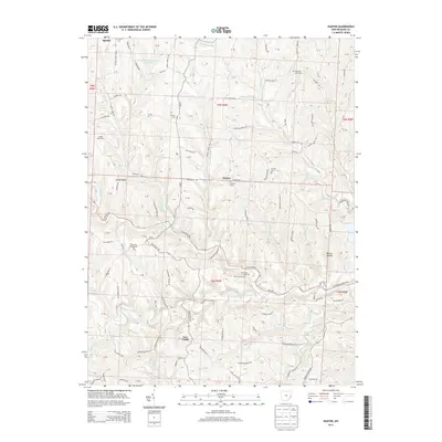
2013 Map of Hunter
USGS Topo · Published 2013About this map
New Castle and Hunter serve as the primary nodes of settlement in this part of Belmont County, where narrow roads follow the ridgelines and creek beds. The landscape is defined by the deep dissection of the Captina Creek watershed, with the North Fork and South Fork drawing a complex web of drainage including Jakes Run, Mikes Run, and Berrys Run. Local history is anchored by numerous small burial grounds such as Chestnut Level Cem and Pleasant Ridge Cem, often situated near high points like Sandy Ridge. The map illustrates a rural economy reliant on traditional land use, exemplified by the Bailey Dairy Farm and the Bethesda Sportsmans Club Pond. A network of township roads, including New Castle Rd and Belmont Ridge Rd, connects these upland communities across the varied topography of Reeves Hollow.
Find a feature on this map
99 named features on this map. Tap any name to fly to it.
Don’t see what you’re looking for? This feature index may not catch every label — zoom into the map to look around manually.
Map Details
Editions of this 2013 Hunter Map
This is the sole edition of this map. No revisions or reprints were ever made.
Other maps of this area

1903 · Flushing
USGS Topo · 1:62,500

1905 · Clarington
USGS Topo · 1:62,500

1905 · St. Clairsville
USGS Topo · 1:62,500

1905 · Woodsfield
USGS Topo · 1:62,500

1905 · Flushing
USGS Topo · 1:62,500

1935 · Clarington
USGS Topo · 1:62,500

1940 · Clarington
USGS Topo · 1:62,500

1949 · Clarksburg
USGS Topo · 1:250,000

1951 · Canton
USGS Topo · 1:250,000

1953 · Canton
USGS Topo · 1:250,000