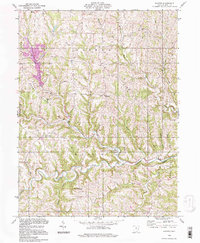
1994 Map of Hunter
USGS Topo · Published 1998About this map
Captina Creek carves a deep valley through the heart of Belmont County, defining the rural character of this landscape at the close of the 20th century. The settlement pattern is anchored by small crossroads such as New Castle and Hunter, while the uplands of Sandy Ridge provide a distinct topographic contrast to the narrow, wooded hollows. Local genealogy is deeply rooted here, evidenced by landmarks like the Chestnut Level Ch Cem and the Center Cem in the north. The area shows evidence of natural resource extraction with a localized Strip Mine, yet remains predominantly defined by its complex drainage network, including Bend Fork and North Fork. The distribution of rural congregations at Pleasant Ridge Ch and Horse Ch suggests a community structure that has persisted for generations in the southeastern Ohio hills.
Find a feature on this map
32 named features on this map. Tap any name to fly to it.
Don’t see what you’re looking for? This feature index may not catch every label — zoom into the map to look around manually.
Map Details
Editions of this 1994 Hunter Map
This is the sole edition of this map. No revisions or reprints were ever made.
Other maps of this area

1903 · Flushing
USGS Topo · 1:62,500

1905 · Clarington
USGS Topo · 1:62,500

1905 · St. Clairsville
USGS Topo · 1:62,500

1905 · Woodsfield
USGS Topo · 1:62,500

1905 · Flushing
USGS Topo · 1:62,500

1935 · Clarington
USGS Topo · 1:62,500

1940 · Clarington
USGS Topo · 1:62,500

1949 · Clarksburg
USGS Topo · 1:250,000

1951 · Canton
USGS Topo · 1:250,000

1953 · Canton
USGS Topo · 1:250,000