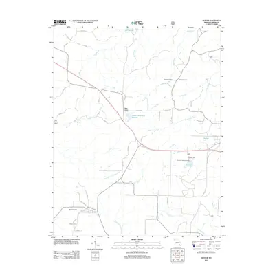
2011 Map of Hunter
USGS Topo · Published 2011About this map
Hunter serves as the primary hub in this corner of Carter County, characterized by a transition from the valley floor of Little Grassy Valley into the forested uplands. The local infrastructure reveals layers of transportation history, including the presence of Old Tram Rd, which hints at former timber or industrial rail activity near the settlement. Water resources are prominent throughout the landscape, ranging from natural features like Elm Springs Lake and the North Prong Little Black River to the Rozark Incorporated Reservoir and Wallace Lake.
Find a feature on this map
61 named features on this map. Tap any name to fly to it.
Don’t see what you’re looking for? This feature index may not catch every label — zoom into the map to look around manually.
Map Details
Editions of this 2011 Hunter Map
This is the sole edition of this map. No revisions or reprints were ever made.
Other maps of this area

1932 · Piedmont
USGS Topo · 1:62,500

1934 · Williamsville
USGS Topo · 1:48,000

1935 · Piedmont
USGS Topo · 1:62,500

1940 · Williamsville
USGS Topo · 1:62,500

1943 · Ellington
USGS Topo · 1:62,500

1944 · Grandin
USGS Topo · 1:62,500

1945 · Ellington
USGS Topo · 1:62,500

1946 · Grandin
USGS Topo · 1:62,500

1949 · Rolla
USGS Topo · 1:250,000

1953 · Rolla
USGS Topo · 1:250,000