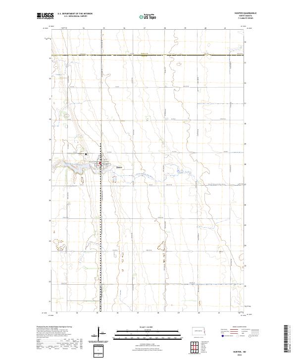
2024 Map of Hunter
USGS Topo · Published 2024About this map
Hunter serves as the central hub of this agricultural landscape in the Red River Valley, situated where the South Branch Elm River meanders across the plain. The map documents a highly structured section-line road network, including notable routes such as Governors Dr, Co Rd 26, and Co Rd 2. This grid reflects the systematic land divisions that have defined North Dakota farming since the original land surveys. Genealogists and local historians will find the Hunter Cem located west of the town center, providing a specific point of reference for family research in Cass County. The border between Traill Co and Cass Co is clearly demarcated at the northern edge of the sheet along 12th St SE, showing how administrative boundaries intersect with the rural homesteads of the region.
Find a feature on this map
44 named features on this map. Tap any name to fly to it.
Don’t see what you’re looking for? This feature index may not catch every label — zoom into the map to look around manually.
Map Details
Editions of this 2024 Hunter Map
This is the sole edition of this map. No revisions or reprints were ever made.
Other maps of this area

1918 · Kelso
USGS Topo · 1:62,500

1943 · Kelso
USGS Topo · 1:62,500

1952 · Grand Forks
USGS Topo · 1:250,000

1956 · Grand Forks
USGS Topo · 1:250,000

1963 · Kelso
USGS Topo · 1:24,000

1966 · Grand Forks
USGS Topo · 1:250,000
1966 · Arthur SE
USGS Topo · 1:24,000

1967 · Ayr NE
USGS Topo · 1:24,000

1967 · Blanchard
USGS Topo · 1:24,000
1967 · Grandin
USGS Topo · 1:24,000