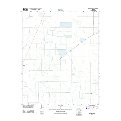
2011 Map of Hunter East
USGS Topo · Published 2011About this map
The town of Hunter sits on the western edge of this landscape, serving as a focal point for a region defined by its intricate drainage network and agricultural grid. In the early 21st century, the area around Hillemann and the small settlement of Four Gums reveals a transition from natural watercourses to a highly managed hydraulic system. Waterways like Big Creek and Pony Creek meander through the terrain, while Cypress Creek marks the eastern reaches. The map documents an extensive network of local transit, including County Rd-134 and SFC 919, which provide access to the rural homesteads and fields. The convergence of West Flat Fork Creek and East Flat Fork Creek in the south illustrates the hydrological importance of this delta-adjacent region, where the land is partitioned into a precise system of sections and rural routes.
Find a feature on this map
31 named features on this map. Tap any name to fly to it.
Don’t see what you’re looking for? This feature index may not catch every label — zoom into the map to look around manually.
Map Details
Editions of this 2011 Hunter East Map
This is the sole edition of this map. No revisions or reprints were ever made.
Other maps of this area

1939 · Wynne
USGS Topo · 1:62,500

1939 · Hunter
USGS Topo · 1:62,500

1940 · Brinkley
USGS Topo · 1:62,500

1940 · Marianna
USGS Topo · 1:62,500

1948 · Helena
USGS Topo · 1:250,000

1950 · Helena
USGS Topo · 1:250,000

1953 · Memphis
USGS Topo · 1:250,000

1955 · Helena
USGS Topo · 1:250,000

1956 · Memphis
USGS Topo · 1:250,000

1956 · Hunter
USGS Topo · 1:62,500