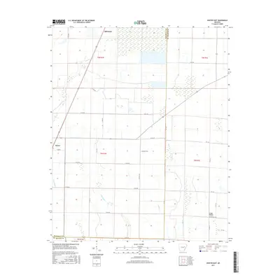
2017 Map of Hunter East
USGS Topo · Published 2017About this map
Hunter and the surrounding agricultural landscape of the Arkansas Delta are meticulously detailed in this 2017 survey. The region is defined by an intricate network of waterways, including Big Cr and the branching paths of E Flat Fork Cr and W Flat Fork Cr, which historically shaped the drainage and development of these lowlands. The settlement of Hillemann sits at a critical junction in the north, while the crossroads at Four Gums anchors the southeastern portion of the sheet. The local road system, including the notably named Slonikers Mill Rd, follows a strict grid that reflects the Public Land Survey System divisions of t5n r1w and adjacent townships. This map provides a clear record of modern rural infrastructure and land management along the Woodruff and St. Francis county line.
Find a feature on this map
34 named features on this map. Tap any name to fly to it.
Don’t see what you’re looking for? This feature index may not catch every label — zoom into the map to look around manually.
Map Details
Editions of this 2017 Hunter East Map
This is the sole edition of this map. No revisions or reprints were ever made.
Other maps of this area

1939 · Wynne
USGS Topo · 1:62,500

1939 · Hunter
USGS Topo · 1:62,500

1940 · Brinkley
USGS Topo · 1:62,500

1940 · Marianna
USGS Topo · 1:62,500

1948 · Helena
USGS Topo · 1:250,000

1950 · Helena
USGS Topo · 1:250,000

1953 · Memphis
USGS Topo · 1:250,000

1955 · Helena
USGS Topo · 1:250,000

1956 · Memphis
USGS Topo · 1:250,000

1956 · Hunter
USGS Topo · 1:62,500