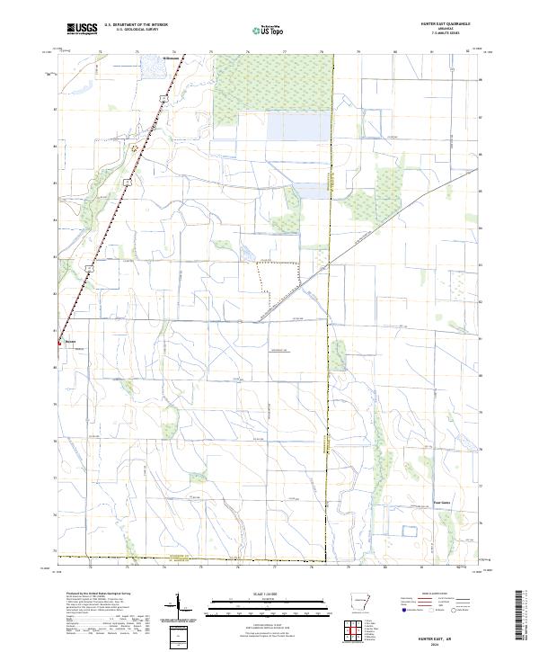
2024 Map of Hunter East
USGS Topo · Published 2024About this map
Hunter and Hillemann anchor this agricultural landscape along the boundary of Woodruff and St. Francis counties. The terrain is defined by a dense network of drainage and creek systems, including East Flat Fork Creek, West Flat Fork Creek, and Pony Creek, which cross the low-lying plains. Historical transportation routes are prominent, most notably the Old Military Rd, which cuts diagonally across the township lines of t6n r1w and t5n r1e. The map illustrates a highly organized grid of rural corridors like Co Rd 580 and Slonikers Mill Rd, serving the small community of Four Gums in the southeast. This survey captures the modern intersection of historic overland paths and the systematic water management essential to the region's delta-border geography.
Find a feature on this map
34 named features on this map. Tap any name to fly to it.
Don’t see what you’re looking for? This feature index may not catch every label — zoom into the map to look around manually.
Map Details
Editions of this 2024 Hunter East Map
This is the sole edition of this map. No revisions or reprints were ever made.
Other maps of this area

1939 · Wynne
USGS Topo · 1:62,500

1939 · Hunter
USGS Topo · 1:62,500

1940 · Brinkley
USGS Topo · 1:62,500

1940 · Marianna
USGS Topo · 1:62,500

1948 · Helena
USGS Topo · 1:250,000

1950 · Helena
USGS Topo · 1:250,000

1953 · Memphis
USGS Topo · 1:250,000

1955 · Helena
USGS Topo · 1:250,000

1956 · Memphis
USGS Topo · 1:250,000

1956 · Hunter
USGS Topo · 1:62,500