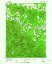
1945 Map of Hunter
USGS Topo · Published 1962About this map
Hunter and Tannersville serve as the primary hubs in this high-elevation landscape within Catskill Park, mapped in the mid-1940s. The settlement pattern follows the narrow valleys of Schoharie Creek and Gooseberry Creek, where development is concentrated alongside several summer camps such as Camp Schoharie and Camp Mayfair. This era captures the region's mid-century transition from earlier resource-based industries toward a seasonal mountain economy, evidenced by landmarks like Onteora Park and the specialized Central Sch in Hunter.
Find a feature on this map
58 named features on this map. Tap any name to fly to it.
Don’t see what you’re looking for? This feature index may not catch every label — zoom into the map to look around manually.
Map Details
Editions of this 1945 Hunter Map
2 editions found
Other maps of this area

1892 · Kaaterskill
USGS Topo · 1:62,500

1893 · Kaaterskill
USGS Topo · 1:62,500

1893 · Durham
USGS Topo · 1:62,500

1894 · Kaaterskill
USGS Topo · 1:62,500

1894 · Durham
USGS Topo · 1:62,500

1899 · Kaaterskill
USGS Topo · 1:62,500

1900 · Phoenicia
USGS Topo · 1:62,500

1901 · Gilboa
USGS Topo · 1:62,500

1903 · Gilboa
USGS Topo · 1:62,500

1903 · Phoenicia
USGS Topo · 1:62,500