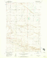
1956 Map of Hunter Lake
USGS Topo · Published 1957About this map
Lake Basin defines the topography of this Stillwater County landscape, where the high plains of Montana meet a complex system of ridges and seasonal water bodies. This mid-century survey captures an era of rural education and early energy exploration, evidenced by local landmarks like Peterson Sch and Leuthold Sch serving the scattered ranching community. The map provides a detailed view of the terrain around Antelope Point and Rattlesnake Ridge, showing the elevation shifts that characterize this portion of the Missouri River Basin development area.
Find a feature on this map
21 named features on this map. Tap any name to fly to it.
Don’t see what you’re looking for? This feature index may not catch every label — zoom into the map to look around manually.
Map Details
Editions of this 1956 Hunter Lake Map
2 editions found
Other maps of this area

1892 · Stillwater
USGS Topo · 1:125,000

1954 · Billings
USGS Topo · 1:250,000

1956 · Hunter Lake
USGS Topo · 1:24,000

1956 · Battle Butte
USGS Topo · 1:24,000

1956 · Horse Butte
USGS Topo · 1:24,000

1956 · Molt
USGS Topo · 1:24,000

1956 · Wheat Basin
USGS Topo · 1:24,000

1956 · Rock Spring
USGS Topo · 1:24,000

1956 · Columbus East
USGS Topo · 1:24,000

1956 · Park City
USGS Topo · 1:24,000