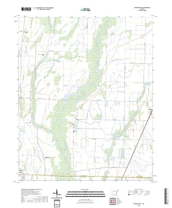
2024 Map of Hunter West
USGS Topo · Published 2024About this map
Cache River National Wildlife Refuge dominates this landscape in the Mississippi Alluvial Plain, where a complex network of wetlands and oxbow lakes defines the geography. The winding path of Bayou De View and Buffalo Creek cut through the terrain, supporting numerous named water bodies like Spivey Lake, Johnson Lake, and Polly Ann Lake. These natural features are interspersed with small agrarian settlements such as Howell, McGregor, and the northern portion of Cotton Plant.
Find a feature on this map
68 named features on this map. Tap any name to fly to it.
Don’t see what you’re looking for? This feature index may not catch every label — zoom into the map to look around manually.
Map Details
Editions of this 2024 Hunter West Map
This is the sole edition of this map. No revisions or reprints were ever made.
Other maps of this area

1935 · Gregory
USGS Topo · 1:62,500

1939 · Hunter
USGS Topo · 1:62,500

1940 · Brinkley
USGS Topo · 1:62,500

1941 · De Valls Bluff
USGS Topo · 1:62,500

1948 · Helena
USGS Topo · 1:250,000

1950 · Helena
USGS Topo · 1:250,000

1953 · Memphis
USGS Topo · 1:250,000

1955 · Helena
USGS Topo · 1:250,000

1956 · Memphis
USGS Topo · 1:250,000

1956 · Hunter
USGS Topo · 1:62,500