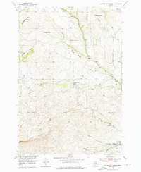
1951 Map of Hunters Hot Springs
USGS Topo · Published 1976About this map
Hunters Hot Springs sits at the southern edge of this landscape, a site of early Montana development featuring a Bathhouse, Substation, and the nearby Hunters School. The terrain is defined by ranching and homesteading history along the boundary of Park and Sweet Grass Counties, where the Base Line separates the northern townships from the rugged south. Numerous family-named sites point to a period of transition, with several locations such as the Roebecker Homestead, Prevost Homestead, and Green School marked as abandoned by the mid-century. Drainage systems like West Fork Duck Creek and Lowell Creek carve through the topography between landmarks with evocative names like Choke-to-death Butte and Antelope Butte. This 1951 field-checked survey preserves the layout of a rural community before further consolidation, including remote features like Hole-in-the Rock and the Murphy Sheep Sheds.
Find a feature on this map
33 named features on this map. Tap any name to fly to it.
Don’t see what you’re looking for? This feature index may not catch every label — zoom into the map to look around manually.
Map Details
Editions of this 1951 Hunters Hot Springs Map
4 editions found
Other maps of this area

1891 · Livingston
USGS Topo · 1:250,000

1893 · Livingston
USGS Topo · 1:250,000

1947 · Bozeman
USGS Topo · 1:250,000

1948 · Bozeman
USGS Topo · 1:250,000

1951 · Ibex Mountain
USGS Topo · 1:24,000

1951 · Grannis
USGS Topo · 1:24,000
1951 · Raspberry Butte
USGS Topo · 1:24,000

1951 · Kelly Hills
USGS Topo · 1:24,000

1951 · Springdale
USGS Topo · 1:24,000

1951 · Hunters Hot Springs
USGS Topo · 1:24,000