
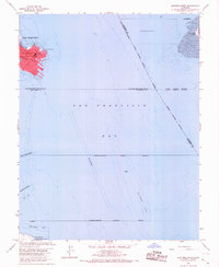
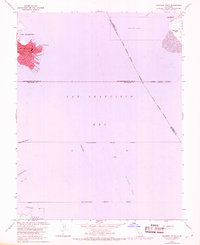
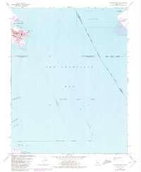
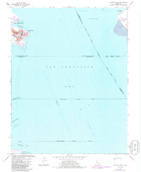
1956 Map of Hunters Point
USGS Topo · Published 1974About this map
US Naval Reservation dominates the peninsula of Hunters Point in this mid-century survey of the southern waterfront. The map illustrates a landscape of maritime industry and infrastructure, showing the Dredged Area and various nautical channels essential for San Francisco's mid-century commerce. Near the industrial core, local streets such as Evans Ave and Innes Ave provide a framework for the residential and manufacturing district around Potrero Viejo.
Find a feature on this map
28 named features on this map. Tap any name to fly to it.
Don’t see what you’re looking for? This feature index may not catch every label — zoom into the map to look around manually.
Map Details
Editions of this 1956 Hunters Point Map
5 editions found
Other maps of this area

1892 · San Mateo
USGS Topo · 1:62,500

1895 · San Francisco
USGS Topo · 1:62,500

1896 · San Mateo
USGS Topo · 1:62,500

1897 · Concord
USGS Topo · 1:62,500

1899 · San Francisco
USGS Topo · 1:62,500

1899 · Haywards
USGS Topo · 1:62,500

1899 · San Mateo
USGS Topo · 1:62,500

1915 · San Mateo
USGS Topo · 1:62,500

1915 · Haywards
USGS Topo · 1:62,500

1915 · Concord
USGS Topo · 1:62,500