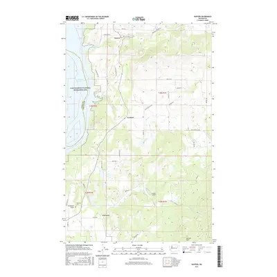
2017 Map of Hunters
USGS Topo · Published 2017About this map
Hunters and Fruitland sit along the eastern highlands of the Columbia River valley, overlooking the expansive waters of Franklin D Roosevelt Lake. This landscape, defined by the rising slopes of Hunters Ridge and the Lake Roosevelt National Recreation Area, shows a network of rural roads connecting small residential nodes and family-owned lands. Further south, the settlement of Enterprise and the nearby Enterprise Valley illustrate the agrarian character of the region, anchored by the Enterprise Cem. The presence of numerous small water bodies, such as Newbill Lake, Mudgett Lake, and Snook Lake, suggests a high water table and a terrain carved by glacial history. Local transit is facilitated by routes like Columbia River Rd and Fruitland Valley Rd, tracing the natural contours toward Boundary Butte.
Find a feature on this map
46 named features on this map. Tap any name to fly to it.
Don’t see what you’re looking for? This feature index may not catch every label — zoom into the map to look around manually.
Map Details
Editions of this 2017 Hunters Map
This is the sole edition of this map. No revisions or reprints were ever made.
Other maps of this area

1948 · Hunters
USGS Topo · 1:62,500

1948 · Wilmont Creek
USGS Topo · 1:62,500

1948 · Lincoln
USGS Topo · 1:62,500

1948 · Turtle Lake
USGS Topo · 1:62,500

1950 · Lincoln
USGS Topo · 1:62,500

1950 · Turtle Lake
USGS Topo · 1:62,500

1950 · Wilmont Creek
USGS Topo · 1:62,500

1950 · Hunters
USGS Topo · 1:62,500

1953 · Ritzville
USGS Topo · 1:250,000

1954 · Okanogan
USGS Topo · 1:250,000