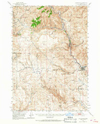
1951 Map of Huntington
USGS Topo · Published 1967About this map
Huntington sits at the eastern edge of this mid-century survey where the Burnt River meets the Snake River, marking a critical juncture for the Union Pacific railroad. The landscape is a rugged collection of peaks and drainages, including Baldy Mtn, Fur Mtn, and Striped Mtn, which define the border between Baker and Malheur counties. This area was a historic corridor for migration and resource extraction, evidenced by the Oregon Trail Mon near Lime and numerous mining sites such as Gold Mine and several Placer Mines. The map documents the intricate network of gulches and creeks like Rye Valley and Dixie Creek that supported early settlement. From the high elevation of Table Rock to the livestock grazing grounds at Birch Creek Meadows, the map captures the transition from industrial limestone quarrying to traditional ranching and mountain transit via the Shoestring Grade.
Find a feature on this map
69 named features on this map. Tap any name to fly to it.
Don’t see what you’re looking for? This feature index may not catch every label — zoom into the map to look around manually.
Map Details
Editions of this 1951 Huntington Map
3 editions found
Other maps of this area

1901 · Baker City
USGS Topo · 1:125,000

1915 · Pine
USGS Topo · 1:125,000

1950 · Jamieson
USGS Topo · 1:62,500

1951 · Moores Hollow
USGS Topo · 1:62,500

1951 · Huntington
USGS Topo · 1:62,500

1952 · Olds Ferry NW
USGS Topo · 1:24,000

1952 · Olds Ferry
USGS Topo · 1:24,000

1952 · Olds Ferry
USGS Topo · 1:62,500

1955 · Baker
USGS Topo · 1:250,000

1957 · Durkee
USGS Topo · 1:62,500