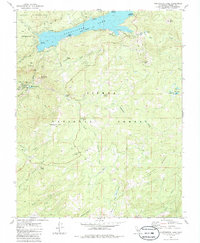
1982 Map of Huntington Lake
USGS Topo · Published 1986About this map
Huntington Lake serves as the focal point of this high-elevation landscape, where the recreational and industrial needs of the 1980s converged. The map details a dense cluster of youth and social retreats along the northern shore, including Camp Keola, Camp Oljato, and Gold Arrow Camp. This area represents a significant era of organized outdoor recreation within the Sierra National Forest.
Find a feature on this map
50 named features on this map. Tap any name to fly to it.
Don’t see what you’re looking for? This feature index may not catch every label — zoom into the map to look around manually.
Map Details
Editions of this 1982 Huntington Lake Map
3 editions found
Other maps of this area

1904 · Kaiser
USGS Topo · 1:125,000

1947 · Mariposa
USGS Topo · 1:250,000

1948 · Mariposa
USGS Topo · 1:250,000

1953 · Huntington Lake
USGS Topo · 1:62,500

1953 · Shaver Lake
USGS Topo · 1:62,500

1953 · Shuteye Peak
USGS Topo · 1:62,500

1953 · Kaiser Peak
USGS Topo · 1:62,500

1957 · Mariposa
USGS Topo · 1:250,000

1963 · Mariposa
USGS Topo · 1:250,000

1980 · Shaver Lake
USGS Topo · 1:100,000