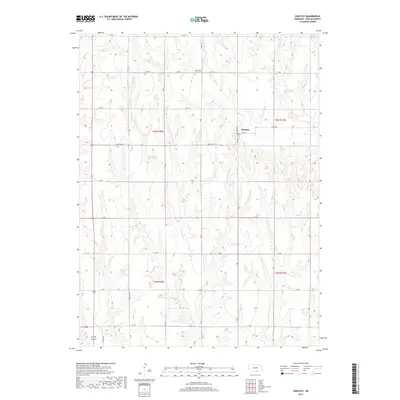
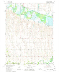
2017 Map of Huntley
USGS Topo · Published 2017About this map
Huntley serves as the primary settlement on this Nebraska landscape, situated near the intersection of State Hwy 42 and Lock St. The area's agricultural character is defined by a systematic grid of section roads and several man-made water features, including Sall Reservoir in the north and Schluntz Reservoir to the east. These reservoirs, alongside Martindale Reservoir, suggest a managed water system critical for the local farming economy.
Find a feature on this map
26 named features on this map. Tap any name to fly to it.
Don’t see what you’re looking for? This feature index may not catch every label — zoom into the map to look around manually.
Map Details
Editions of this 2017 Huntley Map
This is the sole edition of this map. No revisions or reprints were ever made.
Other maps of this area

1896 · Holdrege
USGS Topo · 1:125,000

1955 · Grand Island
USGS Topo · 1:250,000

1957 · Grand Island
USGS Topo · 1:250,000

1958 · Grand Island
USGS Topo · 1:250,000

1970 · Wilcox
USGS Topo · 1:24,000

1970 · Ragan
USGS Topo · 1:24,000
1970 · Atlanta
USGS Topo · 1:24,000
1973 · Orleans
USGS Topo · 1:24,000
1974 · Republican City
USGS Topo · 1:24,000
1974 · Alma SW
USGS Topo · 1:24,000