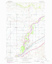
1956 Map of Huntley
USGS Topo · Published 1977About this map
The Yellowstone River cuts a wide, braided path through this mid-century landscape, framing the agricultural development of the Yellowstone Valley. The town of Huntley serves as a central hub, where the Burlington Northern railroad and the Main Canal align with the river's course, illustrating the critical link between transport and irrigation in this semi-arid region. To the north, the terrain transitions into more dissected uplands marked by Razor Creek and the prominent height of Squaw Nipple.
Find a feature on this map
23 named features on this map. Tap any name to fly to it.
Don’t see what you’re looking for? This feature index may not catch every label — zoom into the map to look around manually.
Map Details
Editions of this 1956 Huntley Map
Other maps of this area

1893 · Huntley
USGS Topo · 1:125,000

1954 · Billings
USGS Topo · 1:250,000

1954 · Roundup
USGS Topo · 1:250,000

1956 · Rattlesnake Butte
USGS Topo · 1:24,000

1956 · Huntley
USGS Topo · 1:24,000

1956 · Billings East
USGS Topo · 1:24,000

1957 · Billings
USGS Topo · 1:250,000

1958 · Billings
USGS Topo · 1:250,000

1958 · Roundup
USGS Topo · 1:250,000

1967 · Worden
USGS Topo · 1:24,000