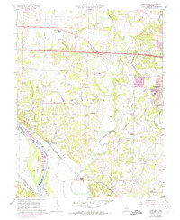
1967 Map of Huntsdale
USGS Topo · Published 1975About this map
Missouri River bottomlands and the dramatic bluffs of western Boone County define this mid-1960s landscape. The river cuts a wide path through the southwest corner, shaping features like Tadpole Island and providing the corridor for the Missouri - Kansas - Texas railroad. This rail line connects the small river communities of Huntsdale and McBaine, which sit at the base of the loess hills. Further north, the early development of Interstate 70 and U.S. 40 bypasses the older settlements of Midway and Midway Heights, signaling a shift toward the highway-oriented growth seen in the expanding western edges of Columbia. Numerous rural burial grounds, including Mt Nebo Cem and Valley Springs Cem, are tucked away among the many branches that feed into Perche Creek, preserving the names of early family landholdings.
Find a feature on this map
45 named features on this map. Tap any name to fly to it.
Don’t see what you’re looking for? This feature index may not catch every label — zoom into the map to look around manually.
Map Details
Editions of this 1967 Huntsdale Map
3 editions found
Other maps of this area

1886 · Jefferson City
USGS Topo · 1:125,000

1888 · Boonville
USGS Topo · 1:125,000

1890 · Moberly
USGS Topo · 1:125,000

1890 · Glasgow
USGS Topo · 1:125,000

1894 · Jefferson City
USGS Topo · 1:125,000

1917 · Sturgeon
USGS Topo · 1:62,500

1935 · Columbia
USGS Topo · 1:24,000

1940 · Columbia
USGS Topo · 1:24,000

1947 · Jefferson City
USGS Topo · 1:250,000
1948 · Columbia
USGS Topo · 1:24,000