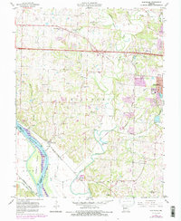
1967 Map of Huntsdale
USGS Topo · Published 1985About this map
Huntsdale and McBaine serve as the primary riverfront settlements on this mid-Missouri landscape, positioned where the rugged bluffs meet the fertile bottomlands of the Missouri River. The drainage network is complex, defined by the winding paths of Perche Creek and Hinkson Creek which flow toward the big river, while Tadpole Island sits prominently in the main channel. The era’s transportation infrastructure is clearly visible, with the Missouri Kansas Texas railroad tracing the river's edge and the modern expansion of Interstate 70 cutting across the northern portion of the map. Genealogists will find a high concentration of burial sites, including Valley Springs Cem, Mt Nebo Cem, and Conley Cem, reflecting generations of settlement. On the eastern edge, the urban growth of Columbia begins to encroach upon the rural landscape, marked by schools like Strawn Sch and Fairview Sch.
Find a feature on this map
50 named features on this map. Tap any name to fly to it.
Don’t see what you’re looking for? This feature index may not catch every label — zoom into the map to look around manually.
Map Details
Editions of this 1967 Huntsdale Map
3 editions found
Other maps of this area

1886 · Jefferson City
USGS Topo · 1:125,000

1888 · Boonville
USGS Topo · 1:125,000

1890 · Moberly
USGS Topo · 1:125,000

1890 · Glasgow
USGS Topo · 1:125,000

1894 · Jefferson City
USGS Topo · 1:125,000

1917 · Sturgeon
USGS Topo · 1:62,500

1935 · Columbia
USGS Topo · 1:24,000

1940 · Columbia
USGS Topo · 1:24,000

1947 · Jefferson City
USGS Topo · 1:250,000
1948 · Columbia
USGS Topo · 1:24,000