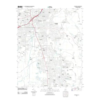
2011 Map of Huntsville
USGS Topo · Published 2011About this map
Huntsville’s urban footprint and its dramatic eastern mountain boundary are well established in this early twenty-first-century survey. The city core is anchored by the Huntsville Post Office and the expansive grounds of Maple Hill Cemetery, while suburban development pushes into the valleys of Mountain Brook and Mountain Heights. The map reveals the intricate drainage patterns of the area, including Pinhook Creek, Aldridge Creek, and the Huntsville Spring Branch, which flow through various neighborhoods and industrial zones. To the east, the steep rise of Monte Sano Mountain and Huntsville Mountain creates a sharp topographical contrast to the developed lowlands.
Find a feature on this map
119 named features on this map. Tap any name to fly to it.
Don’t see what you’re looking for? This feature index may not catch every label — zoom into the map to look around manually.
Map Details
Editions of this 2011 Huntsville Map
This is the sole edition of this map. No revisions or reprints were ever made.
Other maps of this area

1888 · Scottsboro
USGS Topo · 1:125,000

1888 · Huntsville
USGS Topo · 1:125,000

1892 · Huntsville
USGS Topo · 1:125,000

1892 · Scottsboro
USGS Topo · 1:125,000

1936 · Jeff
USGS Topo · 1:24,000

1936 · Triana
USGS Topo · 1:24,000

1936 · New Hope
USGS Topo · 1:24,000

1936 · Madison
USGS Topo · 1:24,000

1936 · Meridianville
USGS Topo · 1:24,000

1936 · Moontown
USGS Topo · 1:24,000
Featured Places
- Huntsville, AL
- Bucks Canyon, Huntsville
- Forest Park, Huntsville
- Bluewood Estates, Huntsville
- Huntsville Park, Huntsville