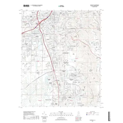
2018 Map of Huntsville
USGS Topo · Published 2018About this map
Monte Sano Mtn and Huntsville Mtn define the eastern rise of this Madison County landscape, where the residential growth of Huntsville presses against the steep terrain of the Cumberland Plateau. Numerous named hollows and coves like McKay Hollow and Esslinger Cove illustrate the complex drainage patterns of the limestone geology, while the presence of The Sinks indicates the subterranean water systems characteristic of the region.
Find a feature on this map
104 named features on this map. Tap any name to fly to it.
Don’t see what you’re looking for? This feature index may not catch every label — zoom into the map to look around manually.
Map Details
Editions of this 2018 Huntsville Map
This is the sole edition of this map. No revisions or reprints were ever made.
Other maps of this area

1888 · Scottsboro
USGS Topo · 1:125,000

1888 · Huntsville
USGS Topo · 1:125,000

1892 · Huntsville
USGS Topo · 1:125,000

1892 · Scottsboro
USGS Topo · 1:125,000

1936 · Jeff
USGS Topo · 1:24,000

1936 · Triana
USGS Topo · 1:24,000

1936 · New Hope
USGS Topo · 1:24,000

1936 · Madison
USGS Topo · 1:24,000

1936 · Meridianville
USGS Topo · 1:24,000

1936 · Moontown
USGS Topo · 1:24,000
Featured Places
- Huntsville, AL
- Bucks Canyon, Huntsville
- Forest Park, Huntsville
- Bluewood Estates, Huntsville
- Huntsville Park, Huntsville