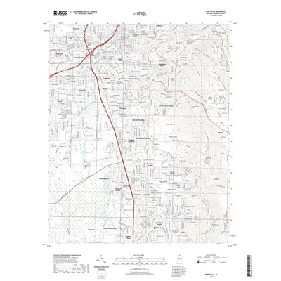
2020 Map of Huntsville
USGS Topo · Published 2020About this map
Huntsville's complex geography is defined by the sharp contrast between its densely developed urban corridors and the steep, wooded slopes of Monte Sano Mtn to the east. The city's reliance on its natural karst hydrology is evident through features like Big Spring and Brahan Spring, which feed the Huntsville Spring Branch as it flows southwest past neighborhoods like Cavalry Hill and Terry Heights. Established institutions such as Oakwood College and the Drake State Community and Technical College stand alongside residential developments that have moved into the coves of the surrounding mountains.
Find a feature on this map
123 named features on this map. Tap any name to fly to it.
Don’t see what you’re looking for? This feature index may not catch every label — zoom into the map to look around manually.
Map Details
Editions of this 2020 Huntsville Map
This is the sole edition of this map. No revisions or reprints were ever made.
Other maps of this area

1888 · Scottsboro
USGS Topo · 1:125,000

1888 · Huntsville
USGS Topo · 1:125,000

1892 · Huntsville
USGS Topo · 1:125,000

1892 · Scottsboro
USGS Topo · 1:125,000

1936 · Jeff
USGS Topo · 1:24,000

1936 · Triana
USGS Topo · 1:24,000

1936 · New Hope
USGS Topo · 1:24,000

1936 · Madison
USGS Topo · 1:24,000

1936 · Meridianville
USGS Topo · 1:24,000

1936 · Moontown
USGS Topo · 1:24,000
Featured Places
- Huntsville, AL
- Bucks Canyon, Huntsville
- Forest Park, Huntsville
- Bluewood Estates, Huntsville
- Huntsville Park, Huntsville