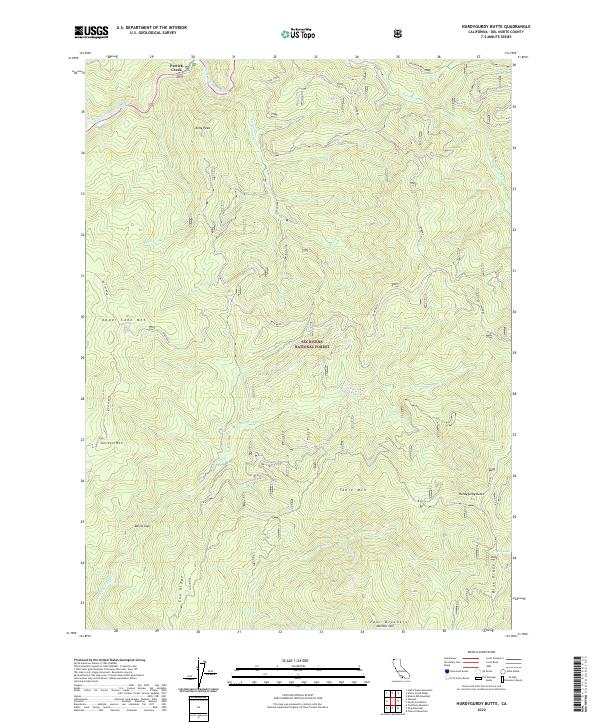
2022 Map of Hurdygurdy Butte
USGS Topo · Published 2022About this map
Smith Wild and Scenic River defines the drainage patterns of this northern California landscape, where the Middle Fork Smith River meets Patrick Creek. Located within the Six Rivers National Forest, the terrain is characterized by significant elevations including Hurdygurdy Butte and the Four Brothers Number One peak to the south. The map illustrates a region managed for conservation and recreation, with Big Flat Road providing one of the few primary access points through the high ridges. Researchers can identify geographical landmarks such as Devils Gap and Fox Ridge, while water features like Hurdygurdy Cr and the small Elk Lake tucked against Blue Ridge suggest the area's complex hydrology and natural drainage basins.
Find a feature on this map
23 named features on this map. Tap any name to fly to it.
Don’t see what you’re looking for? This feature index may not catch every label — zoom into the map to look around manually.
Map Details
Editions of this 2022 Hurdygurdy Butte Map
This is the sole edition of this map. No revisions or reprints were ever made.
Other maps of this area

1922 · Preston Peak
USGS Topo · 1:125,000

1945 · Ship Mountain
USGS Topo · 1:62,500

1945 · Gasquet
USGS Topo · 1:62,500

1948 · Weed
USGS Topo · 1:250,000

1950 · Weed
USGS Topo · 1:250,000

1951 · Gasquet
USGS Topo · 1:62,500

1952 · Ship Mountain
USGS Topo · 1:62,500

1955 · Dillon Mtn
USGS Topo · 1:62,500

1956 · Preston Peak
USGS Topo · 1:62,500

1958 · Weed
USGS Topo · 1:250,000