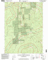
1997 Map of Hurdygurdy Butte
USGS Topo · Published 2001About this map
Hurdygurdy Butte and the surrounding high ridges of the Six Rivers National Forest define this remote region of Del Norte County. The landscape is dominated by the complex drainage systems of the Middle Fork Smith River, with numerous prospects and at least one mine tucked into the steep slopes of Gordon Mountain and French Hill. This 1990s revision by the Forest Service highlights a terrain shaped by both historic transport and modern conservation, featuring the Gasquet Toll Road and sections designated as a Wild and Scenic River. The presence of the Upper Coon Mtn Shelter and various river access points indicates the area's transition into the Smith River National Recreation Area, where recreation has largely superseded the extractive mining efforts of previous decades.
Find a feature on this map
29 named features on this map. Tap any name to fly to it.
Don’t see what you’re looking for? This feature index may not catch every label — zoom into the map to look around manually.
Map Details
Editions of this 1997 Hurdygurdy Butte Map
This is the sole edition of this map. No revisions or reprints were ever made.
Other maps of this area

1922 · Preston Peak
USGS Topo · 1:125,000

1945 · Ship Mountain
USGS Topo · 1:62,500

1945 · Gasquet
USGS Topo · 1:62,500

1948 · Weed
USGS Topo · 1:250,000

1950 · Weed
USGS Topo · 1:250,000

1951 · Gasquet
USGS Topo · 1:62,500

1952 · Ship Mountain
USGS Topo · 1:62,500

1955 · Dillon Mtn
USGS Topo · 1:62,500

1956 · Preston Peak
USGS Topo · 1:62,500

1958 · Weed
USGS Topo · 1:250,000