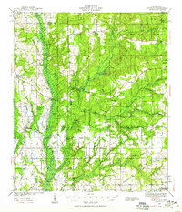
1941 Map of Hurley
USGS Topo · Published 1959About this map
The Escawpa River carves a wide swampy corridor through this landscape at the start of the 1940s, marking the boundary between Mississippi and Alabama. This era of the Gulf Coastal Plain is defined by small, family-centered settlements and landings that served the river-and-rail economy. Landmarks like Galloway Landing and Slaughter Flat Landing denote where timber or goods likely met the water, while several river bluffs, including Yellow Bluff and Miles Bluff, punctuate the shoreline.
Find a feature on this map
70 named features on this map. Tap any name to fly to it.
Don’t see what you’re looking for? This feature index may not catch every label — zoom into the map to look around manually.
Map Details
Editions of this 1941 Hurley Map
3 editions found
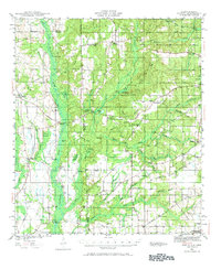
Other maps of this area

1921 · Grand Bay
USGS Topo · 1:62,500

1921 · Delchamps
USGS Topo · 1:62,500

1922 · Mobile
USGS Topo · 1:62,500

1940 · Mobile
USGS Topo · 1:62,500

1941 · Cedar Point
USGS Topo · 1:62,500

1941 · Hurley
USGS Topo · 1:62,500

1941 · Vancleave
USGS Topo · 1:62,500

1941 · Creola
USGS Topo · 1:62,500

1941 · Lucedale
USGS Topo · 1:62,500

1942 · Kushla
USGS Topo · 1:31,680