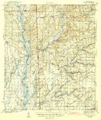
1943 Map of Hurley
USGS Topo · Published 1943About this map
The Escatawpa River and Pascagoula River systems dominate this early 1940s landscape, creating a complex network of wetlands and bluffs along the Alabama-Mississippi border. Small rural communities like Hurley and Tanner Williams serve as anchors in an area defined by its river-and-rail economy. The Mississippi Export railroad cuts through the western portion of the sheet, connecting timber or agricultural interests to the broader gulf region.
Find a feature on this map
58 named features on this map. Tap any name to fly to it.
Don’t see what you’re looking for? This feature index may not catch every label — zoom into the map to look around manually.
Map Details
Editions of this 1943 Hurley Map
2 editions found

Other maps of this area

1921 · Grand Bay
USGS Topo · 1:62,500

1921 · Delchamps
USGS Topo · 1:62,500

1922 · Mobile
USGS Topo · 1:62,500

1940 · Mobile
USGS Topo · 1:62,500

1941 · Cedar Point
USGS Topo · 1:62,500

1941 · Hurley
USGS Topo · 1:62,500

1941 · Vancleave
USGS Topo · 1:62,500

1941 · Creola
USGS Topo · 1:62,500

1941 · Lucedale
USGS Topo · 1:62,500

1942 · Kushla
USGS Topo · 1:31,680