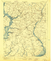
1905 Map of Hurlock
USGS Topo · Published 1928About this map
The Choptank River and Marshyhope Creek define the geography of the Eastern Shore in this early twentieth-century study, where deep-water navigation meets inland rail commerce. At Hurlock, the intersection of the Baltimore Chesapeake and Atlantic Railroad and the Cambridge and Seaford Railroad creates a vital transportation hub for Dorchester County. The map documents an era of river-based logistics, tracing a Steamboat Route past Steamboat Landing and Jamaica Pt. Smaller settlements like Linchester, Federalsburg, and East New Market are shown in detail, alongside rural landmarks such as Shiloh Church and the Wheatley Camp Ground. The detailed surveying reveals the complex network of tidal creeks and branches, including Hunting Creek and the Chicamacomico River, that shaped the region's early agricultural and industrial development.
Find a feature on this map
66 named features on this map. Tap any name to fly to it.
Don’t see what you’re looking for? This feature index may not catch every label — zoom into the map to look around manually.
Map Details
Editions of this 1905 Hurlock Map
3 editions found
Other maps of this area

1898 · Choptank
USGS Topo · 1:125,000

1898 · St. Marys
USGS Topo · 1:125,000

1901 · Salisbury
USGS Topo · 1:62,500

1903 · Nanticoke
USGS Topo · 1:62,500

1904 · St. Michaels
USGS Topo · 1:62,500

1904 · Oxford
USGS Topo · 1:62,500

1905 · Crapo
USGS Topo · 1:62,500

1905 · Denton
USGS Topo · 1:62,500

1905 · Hurlock
USGS Topo · 1:62,500

1906 · St. Marys
USGS Topo · 1:125,000