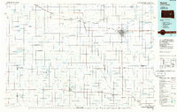
1985 Map of Huron
USGS Topo · Published 1986About this map
The James River valley anchors this mid-1980s landscape of eastern South Dakota, where the city of Huron serves as a regional hub for rail and road commerce. The map documents a highly managed prairie environment, characterized by an extensive system of State Game Production Areas and National Waterfowl Production Areas that weave through the traditional section-line grid. Significant settlements including Wessington Springs, Woonsocket, and Alpena are shown alongside communal agrarian sites like Riverside Colony and Spring Valley Colony. The transport network is defined by the Chicago and North Western and Burlington Northern railroads, which linked grain elevators in towns like Wolsey and Vayland to larger markets. Water management is a visible priority, with numerous flowing wells and drainage features such as Shue Creek, Firesteel Creek, and Pearl Creek feeding into the primary river system.
Find a feature on this map
68 named features on this map. Tap any name to fly to it.
Don’t see what you’re looking for? This feature index may not catch every label — zoom into the map to look around manually.
Map Details
Editions of this 1985 Huron Map
2 editions found
Other maps of this area

1895 · Byron
USGS Topo · 1:125,000

1898 · Huron
USGS Topo · 1:125,000

1899 · Mitchell
USGS Topo · 1:125,000

1899 · Alexandria
USGS Topo · 1:125,000

1899 · Redfield
USGS Topo · 1:125,000

1899 · De Smet
USGS Topo · 1:125,000

1941 · Pukwana
USGS Topo · 1:62,500

1941 · Kimball North
USGS Topo · 1:62,500

1942 · Crow Lake
USGS Topo · 1:62,500

1949 · Vayland SE
USGS Topo · 1:24,000